Mostra el registre d'ítem simple
AkvaGIS: an open source tool for water quantity and quality management
| dc.contributor.author | Criollo Manjarrez, Rotman Alejandro |
| dc.contributor.author | Velasco Mansilla, Domitila Violeta |
| dc.contributor.author | Nardi Ricart, Albert |
| dc.contributor.other | Universitat Politècnica de Catalunya. Departament d'Enginyeria Civil i Ambiental |
| dc.date.accessioned | 2019-05-02T14:13:17Z |
| dc.date.available | 2019-05-02T14:13:17Z |
| dc.date.issued | 2019-06 |
| dc.identifier.citation | Criollo, R.; Velasco Mansilla, D.V.; Nardi, A. AkvaGIS: an open source tool for water quantity and quality management. "Computers and geosciences", Juny 2019, vol. 127, p. 123-132. |
| dc.identifier.issn | 0098-3004 |
| dc.identifier.uri | http://hdl.handle.net/2117/132546 |
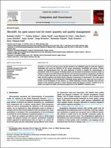
| dc.description.abstract | AkvaGIS is a novel, free and open source module included in the FREEWAT plugin for QGIS that supplies a standardized and easy-to-use workflow for the storage, management, visualization and analysis of hydrochemical and hydrogeological data. The main application is devised to simplify the characterization of groundwater bodies for the purpose of building rigorous and data-based environmental conceptual models (as required in Europe by the Water Framework Directive). For data-based groundwater management, AkvaGIS can be used to prepare input files for most groundwater flow numerical models in all of the available formats in QGIS. AkvaGIS is applied in the Walloon Region (Belgium) to demonstrate its functionalities. The results support a better understanding of the hydrochemical relationship among aquifers in the region and can be used as a baseline for the development of new analyses, e.g., further delineation of nitrate vulnerable zones and management of the monitoring network to control chemical spatial and temporal evolution. AkvaGIS can be expanded and adapted for further environmental applications as the FREEWAT community grows. |
| dc.format.extent | 10 p. |
| dc.language.iso | eng |
| dc.rights | Attribution-NonCommercial-NoDerivs 3.0 Spain |
| dc.rights.uri | http://creativecommons.org/licenses/by-nc-nd/3.0/es/ |
| dc.subject | Àrees temàtiques de la UPC::Enginyeria civil::Geologia::Hidrologia subterrània |
| dc.subject.lcsh | Groundwater--Computer programs |
| dc.subject.other | Geographic Information System (GIS) Water resource management Groundwater Geomatics Free and Open Source FREEWAT Walloon Region |
| dc.title | AkvaGIS: an open source tool for water quantity and quality management |
| dc.type | Article |
| dc.subject.lemac | Aigües subterrànies -- Programes d'ordinador |
| dc.contributor.group | Universitat Politècnica de Catalunya. GHS - Grup d'Hidrologia Subterrània |
| dc.identifier.doi | 10.1016/j.cageo.2018.10.012 |
| dc.description.peerreviewed | Peer Reviewed |
| dc.relation.publisherversion | https://www.sciencedirect.com/science/article/pii/S0098300417312311 |
| dc.rights.access | Open Access |
| local.identifier.drac | 24253247 |
| dc.description.version | Postprint (published version) |
| dc.relation.projectid | info:eu-repo/grantAgreement/EC/H2020/642224/EU/FREE and open source software tools for WATer resource management/FREEWAT |
| local.citation.author | Criollo, R.; Velasco Mansilla, D.V.; Nardi, A. |
| local.citation.publicationName | Computers and geosciences |
| local.citation.volume | 127 |
| local.citation.startingPage | 123 |
| local.citation.endingPage | 132 |
Fitxers d'aquest items
Aquest ítem apareix a les col·leccions següents
-
Articles de revista [3.002]
-
Articles de revista [215]


