Mostra el registre d'ítem simple
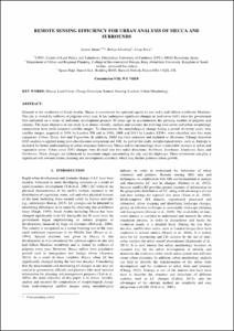
REMOTE SENSING EFFICIENCY FOR URBAN ANALYSIS OF MECCA AND SURROUNDS
| dc.contributor.author | Iman, Ayman |
| dc.contributor.author | Alhaddad, Bahaa |
| dc.contributor.author | Roca Cladera, Josep |
| dc.contributor.other | Universitat Politècnica de Catalunya. Departament de Tecnologia de l'Arquitectura |
| dc.coverage.spatial | east=39.85791180000001; north=21.3890824; name=An Nasim, Mecca Aràbia Saudita |
| dc.date.accessioned | 2016-09-02T10:35:04Z |
| dc.date.available | 2016-09-02T10:35:04Z |
| dc.date.issued | 2016 |
| dc.identifier.citation | Iman, A., Alhaddad, B., Roca, J. REMOTE SENSING EFFICIENCY FOR URBAN ANALYSIS OF MECCA AND SURROUNDS. A: International Society for Photogrammetry and Remote Sensing Congress. "The International Archives of the Photogrammetry, Remote Sensing and Spatial Information Sciences". Praga: International Society for Photogrammetry and Remote Sensing (ISPRS), 2016, p. 905-910. |
| dc.identifier.uri | http://hdl.handle.net/2117/89480 |
| dc.description.abstract | Situated in the southwest of Saudi Arabia, Mecca is considered the spiritual capital of one and a half billion worldwide Muslims. The city is visited by millions of pilgrims every year. It has undergone significant changes in land cover (LC) since the government first embarked on a series of ambitious development projects 20 years ago to accommodate the growing number of pilgrims and citizens. The main objective of our study is to detect, identify, analyze and measure the evolving land cover and urban morphology composition from multi-temporal satellite images. To characterize the morphological change during a period of twenty years, four satellite images, acquired in 1998 by Landsat TM and in 2003, 2008 and 2013 by Landsat ETM+, were classified into five main categories: Urban, Street, Soil and Vegetation. In addition, DEM has been extracted and included as Mountain. Change detection (CD) analysis is applied using post-classification comparison and GIS. As part of the study, morphological index, such as, Entropy is included for better understanding of urban structures behaviour. Mecca and its surroundings show a noticeable increase in urban and vegetation cover. Urban cover (UC) changes were divided into five radial directions: Northeast, Southeast, Southwest, East, and Northwest. These changes are influenced by mountain ranges surrounding the city and the highways. These revelations can play a significant role towards future planning and development activities, which may further promote urban growth. |
| dc.format.extent | 6 p. |
| dc.language.iso | eng |
| dc.publisher | International Society for Photogrammetry and Remote Sensing (ISPRS) |
| dc.rights.uri | http://creativecommons.org/licenses/by-nc-nd/3.0/es/ |
| dc.subject | Àrees temàtiques de la UPC::Urbanisme::Planejament urbà |
| dc.subject.lcsh | City planning -- Saudi Arabia -- Mecca |
| dc.subject.lcsh | Urban morphology -- Saudi Arabia -- Mecca |
| dc.subject.lcsh | Remote sensing -- Saudi Arabia -- Mecca |
| dc.subject.other | Mecca |
| dc.subject.other | Land cover |
| dc.subject.other | Change detection |
| dc.subject.other | Remote sensing |
| dc.subject.other | Landsat |
| dc.subject.other | Urban morphology |
| dc.title | REMOTE SENSING EFFICIENCY FOR URBAN ANALYSIS OF MECCA AND SURROUNDS |
| dc.type | Conference report |
| dc.subject.lemac | Urbanisme -- Arabia Saudita -- La Meca |
| dc.subject.lemac | Morfologia urbana -- Arabia Saudita -- La Meca |
| dc.subject.lemac | Teledetecció -- Arabia Saudita -- La Meca |
| dc.contributor.group | Universitat Politècnica de Catalunya. CPSV - Centre de Política de Sòl i Valoracions |
| dc.identifier.doi | 10.5194/isprs-archives-XLI-B8-905-2016 |
| dc.relation.publisherversion | http://www.int-arch-photogramm-remote-sens-spatial-inf-sci.net/XLI-B8/905/2016/ |
| dc.rights.access | Open Access |
| local.identifier.drac | 18773567 |
| dc.description.version | Postprint (published version) |
| local.citation.author | Iman, A.; Alhaddad, B.; Roca, J. |
| local.citation.contributor | International Society for Photogrammetry and Remote Sensing Congress |
| local.citation.pubplace | Praga |
| local.citation.publicationName | The International Archives of the Photogrammetry, Remote Sensing and Spatial Information Sciences |
| local.citation.startingPage | 905 |
| local.citation.endingPage | 910 |