Exploració per autor "Marcello, Javier"
Ara es mostren els items 1-7 de 7
-
Activities of the IEEE GRSS Spain Chapter

Marcello, Javier; Piles de la Fuente, María Pilar; Camps Valls, Gustau; López Martínez, Carlos; Álvarez Pérez, José Luis; Plaza Miguel, Antonio (Institute of Electrical and Electronics Engineers, 2019-06-01)
Marcello, Javier; Piles de la Fuente, María Pilar; Camps Valls, Gustau; López Martínez, Carlos; Álvarez Pérez, José Luis; Plaza Miguel, Antonio (Institute of Electrical and Electronics Engineers, 2019-06-01)
Article
Accés obertPresents information on various GRSS Society chapters -
Analysis of urban and vegetation growing in NW Senegal during the last 25 years using medium resolution imagery

Marcello, Javier; Calderero Patino, Felipe; Eugenio, Francisco; Marqués Acosta, Fernando (Institute of Electrical and Electronics Engineers (IEEE), 2014)
Marcello, Javier; Calderero Patino, Felipe; Eugenio, Francisco; Marqués Acosta, Fernando (Institute of Electrical and Electronics Engineers (IEEE), 2014)
Text en actes de congrés
Accés restringit per política de l'editorialLand use and land cover information are key information for Governments in developing countries. In this context, remote sensing satellites like Landsat or SPOT can provide valuable data covering several decades. We have ... -
Cloud motion estimation in seviri image sequences

Marcello, Javier; Eugenio, Francisco Javier; Marqués Acosta, Fernando (2009)
Marcello, Javier; Eugenio, Francisco Javier; Marqués Acosta, Fernando (2009)
Text en actes de congrés
Accés obertDetermination of atmospheric dynamic characteristics from remote sensing imagery is fundamental in weather and climate studies. The SEVIRI radiometer, on board the MSG, with its 12 bands and 15 minutes sensing ... -
Hierarchical segmentation of vegetation areas in high spatial resolution images by fusion of multispectral information

Calderero Patino, Felipe; Marqués Acosta, Fernando; Marcello, Javier; Eugenio, Francisco Javier (2009)
Calderero Patino, Felipe; Marqués Acosta, Fernando; Marcello, Javier; Eugenio, Francisco Javier (2009)
Text en actes de congrés
Accés obertA new region-based methodology for the automated extraction and hierarchical segmentation of vegetation areas into high spatial resolution images is proposed. This approach is based on the iterative and cooperative ... -
On the use of GNSS-R data to correct L-band brightness temperatures for sea-state effects: results of the ALBATROSS field experiments

Valencia Domènech, Enric; Camps Carmona, Adriano José; Bosch Lluís, Xavier; Rodríguez Álvarez, Nereida; Ramos Pérez, Isaac; Eugenio, Francisco Javier; Marcello, Javier (IEEE Press. Institute of Electrical and Electronics Engineers, 2011-09)
Valencia Domènech, Enric; Camps Carmona, Adriano José; Bosch Lluís, Xavier; Rodríguez Álvarez, Nereida; Ramos Pérez, Isaac; Eugenio, Francisco Javier; Marcello, Javier (IEEE Press. Institute of Electrical and Electronics Engineers, 2011-09)
Article
Accés restringit per política de l'editorialSea surface salinity is a key oceanographic parameter that can be measured by means of L-band microwave radiometry. The measured brightness temperatures over the ocean are influenced by the sea state, which can entirely ... -
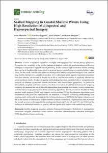
Seabed mapping in coastal shallow waters using high resolution multispectral and hyperspectral imagery

Marcello, Javier; Eugenio, Francisco; Martín Abasolo, Javier; Marqués Acosta, Fernando (Multidisciplinary Digital Publishing Institute (MDPI), 2018-08-01)
Marcello, Javier; Eugenio, Francisco; Martín Abasolo, Javier; Marqués Acosta, Fernando (Multidisciplinary Digital Publishing Institute (MDPI), 2018-08-01)
Article
Accés obertCoastal ecosystems experience multiple anthropogenic and climate change pressures. To monitor the variability of the benthic habitats in shallow waters, the implementation of effective strategies is required to support ... -
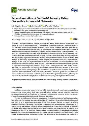
Super-resolution of Sensinel-2 imagery using generative adversarial networks

Salgueiro Romero, Luis Fernando; Marcello, Javier; Vilaplana Besler, Verónica (Multidisciplinary Digital Publishing Institute (MDPI), 2020-07-28)
Salgueiro Romero, Luis Fernando; Marcello, Javier; Vilaplana Besler, Verónica (Multidisciplinary Digital Publishing Institute (MDPI), 2020-07-28)
Article
Accés obertSentinel-2 satellites provide multi-spectral optical remote sensing images with four bands at 10 m of spatial resolution. These images, due to the open data distribution policy, are becoming an important resource for several ...


