Exploració per altres contribucions "Juan Zornoza, José Miguel"
Ara es mostren els items 1-15 de 15
-
Analysis of ionospheric scintillation in GNSS signals

(Universitat Politècnica de Catalunya, 2021-06-22)
(Universitat Politècnica de Catalunya, 2021-06-22)
Projecte Final de Màster Oficial
Accés obertScintillation is a particular type of space weather disturbance that currently limits the accuracy and availability of the Global Navigation Satellite System. The present final master’s thesis aims to study the characteristics ... -
Consolidation and assessment of a technique to provide fast and precise point positioning (Fast-PPP)


(Universitat Politècnica de Catalunya, 2016-01-21)
(Universitat Politècnica de Catalunya, 2016-01-21)
Tesi
Accés obertThe research of this paper-based dissertation is focused on the Fast Precise Point Positioning (Fast-PPP) technique. The novelty relies on using an accurate ionosphere model, in combination with the standard precise satellite ... -
Contributions to ionospheric electron density retrieval

(Universitat Politècnica de Catalunya, 2010-02-22)
(Universitat Politècnica de Catalunya, 2010-02-22)
Tesi
Accés obertLa transformada de Abel es una técnica de inversión usada frecuentemente en radio ocultaciones (RO) que, en el contexto ionosférico, permite deducir densidades electrónicas a partir de datos de STEC (Slant Total Electron ... -
Contributions to the 3D ionospheric sounding with GPS data

(Universitat Politècnica de Catalunya, 2004-03-15)
(Universitat Politècnica de Catalunya, 2004-03-15)
Tesi
Accés obertLa tesi proposa una sèrie d'algoritmes destinats a obtenir informació del contingut d'electrons lliures presents a la ionosfera. El tipus de dades que s'utilitzaran seran bàsicament les corresponents a receptors de dades ... -
Design and implementation of cycle-slip detectors for for Dual-frequency GNSS Signals

(Universitat Politècnica de Catalunya, 2016-03-16)
(Universitat Politècnica de Catalunya, 2016-03-16)
Projecte Final de Màster Oficial
Accés obertIntroduction: Satellite navigation systems are widely used for today's high accuracy applications demanding the most accurate ranging information obtainable, which is the carrier phase observable. Before the carrier phase ... -
Determination of Monitor Thresholds for a GBAS ground station

(Universitat Politècnica de Catalunya, 2015-07-29)
(Universitat Politècnica de Catalunya, 2015-07-29)
Projecte Final de Màster Oficial
Accés restringit per decisió de l'autorThe Ground Based Augmentation System (GBAS) is designed to provide sufficient availability of accuracy, continuity, and integrity to satisfy the demanding requirements of aircraft precision approach, landing, and surface ... -
Establishment of Sigma Ground for GBAS

(Universitat Politècnica de Catalunya, 2015-07-29)
(Universitat Politècnica de Catalunya, 2015-07-29)
Projecte Final de Màster Oficial
Accés restringit per decisió de l'autorThe Ground based Augmentation System (GBAS) is being developed to enable precision approach and landing operations using the Global Positioning System (GPS). Each GBAS installation provides services through a GBAS Ground ... -
Experiments on Point Positionings in gLAB with real data in Viet Nam

(Universitat Politècnica de Catalunya, 2014-10-01)
(Universitat Politècnica de Catalunya, 2014-10-01)
Projecte Final de Màster Oficial
Accés restringit per decisió de l'autor- Knowledge, skills and competence to be acquired: Fast Precise Positioning experiment. - Detailed program of the training period: The student shall work in the framework of G-NAVIS project. The activities are devoted to ... -
gLAB upgrade with BeiDou navigation system signals

(Universitat Politècnica de Catalunya, 2015-06-30)
(Universitat Politècnica de Catalunya, 2015-06-30)
Projecte Final de Màster Oficial
Accés obertThe gLAB tool suit is an educational and professional multipurpose GNSS data processing software. It has been developed by gAGE/UPC under a contract of the European Space Agency (ESA). The current version of gLAB allows ... -
gLAB upgrade with EGNOS data processing

(Universitat Politècnica de Catalunya, 2016-06)
(Universitat Politècnica de Catalunya, 2016-06)
Projecte/Treball Final de Carrera
Accés obertgLAB is a free open-source software to process GNSS data. The first release of this software package allows full processing capability of GPS data, and partial handling of Galileo and GLONASS data. EGNOS is the european ... -
Implementation of GNSS ionospheric models in gLAB

(Universitat Politècnica de Catalunya, 2014-12)
(Universitat Politècnica de Catalunya, 2014-12)
Projecte/Treball Final de Carrera
Accés obert[ANGLÈS] gLAB is an open source tool developed in gAGE group under the terms of an ESA contract. It currently processes full GPS data, being capable of doing precise point positioning. With the appearance of new satellite ... -
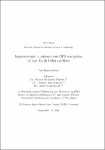
Improvements in autonomous GPS navigation of Low Earth Orbit satellites

(Universitat Politècnica de Catalunya, 2008-10-24)
(Universitat Politècnica de Catalunya, 2008-10-24)
Tesi
Accés obertEs defineix un satèl·lit d'òrbita baixa aquell que es troba a una alçada de fins a 2000 km per sobre de la superfície de la Terra. Degut al ràpid decaïment dels objectes propers a la superfície degut al fregament atmosfèric, ... -
Network-based ionospheric gradient monitoring to support ground based augmentation systems

(Universitat Politècnica de Catalunya, 2022-07-12)
(Universitat Politècnica de Catalunya, 2022-07-12)
Tesi
Accés obertThe Ground Based Augmentation System (GBAS) is a local-area, airport-based augmentation of Global Navigation Satellite Systems (GNSSs) that provides precision approach guidance for aircraft. It enhances GNSS performance ... -
Orbit ephemeris monitor for GBAS cat-I aircraft precision approach operations

(Universitat Politècnica de Catalunya, 2014-10-01)
(Universitat Politècnica de Catalunya, 2014-10-01)
Projecte Final de Màster Oficial
Accés restringit per decisió de l'autorThe Ground based Augmentation System (GBAS) is being developed to enable precision approach and landing operations using the Global Positioning System (GPS). Each GBAS installation provides services through a GBAS Ground ... -
World-wide analysis and modelling of the ionospheric and plasmaspheric electron contents by means of radio occultations

(Universitat Politècnica de Catalunya, 2019-02-25)
(Universitat Politècnica de Catalunya, 2019-02-25)
Tesi
Accés obertThe research of this dissertation is studying the ionosphere by GPS radio occultation (RO) techniques. It is mainly divided into two parts. The first part focuses on the methodology in electron density profile retrievals ...


